
scanning

RIEGL technology has been implemented in a series of projects by the U.S. Army Corps of Engineer’s Cold Regions Research and Engineering Laboratory (C...
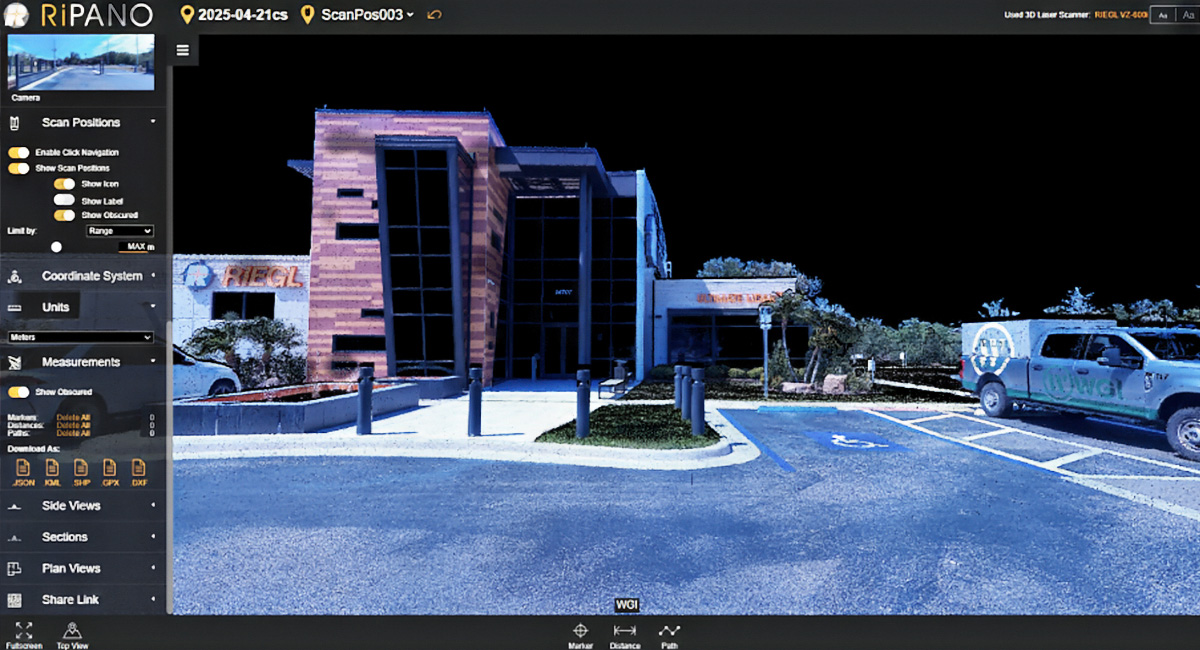
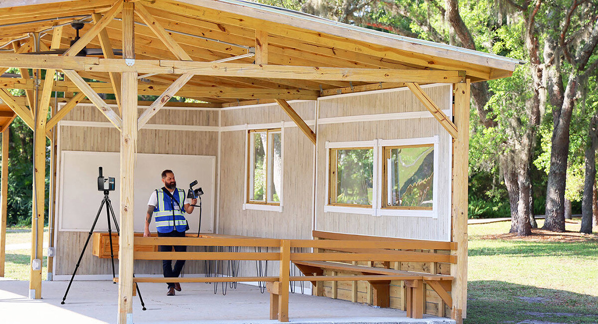
WGI, a leading national design and professional services firm headquartered in West Palm Beach, FL, finalised training at RIEGL USA and took delivery ...
RIEGL’s VQ-840-GL Topo-Bathymetric LiDAR sensor to enhance their below-water environmental research projects. This collaboration marks a significant a...
Understanding the impacts of forest disturbances on forest structure – and consequently, their capacity to buffer climate change impacts by regulating...

For over three and a half decades, the men and women at Pratt Miller, a high-performance engineering and advanced technology leader for motorsports, d...

For nearly 15 years, RIEGL and Diamond Aircraft have established a fruitful relationship, ensuring success for both companies and their esteemed custo...
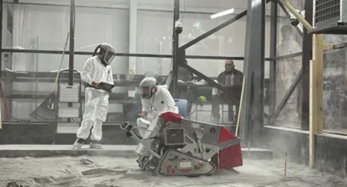
To the Moon and Beyond: RIEGL USA, Allen & Company, NASA, and UCF Team Up for the Second Year in the 2025 Lunabotics Challenge. Utilising the RIEG...
Protecting the Unseen: Non-Invasive Seabed and Coral Reef Mapping with RIEGL Aerial Bathymetric LiDAR. AB Surveying & Development, a leading surve...
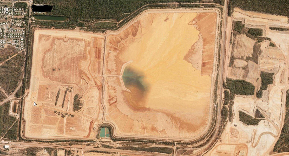
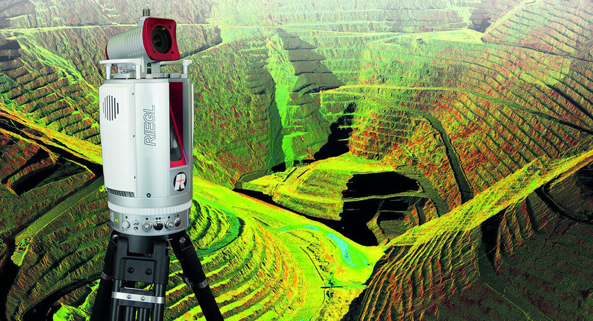
The task faced by many large Mining Companies to quantify geographically large Tailings Storage Facilities surfaces and materials is an ever-evolving ...
Gullies are landscape erosional features impacting large areas globally. Sediment eroded from gullies is known to result in agricultural production lo...
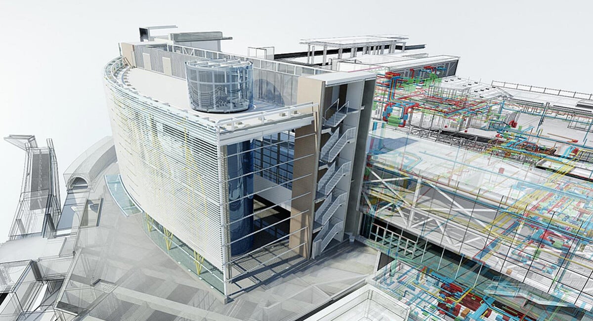
The construction industry is undergoing a digital transformation, and at the heart of this revolution is Building Information Modeling (BIM). BIM is m...
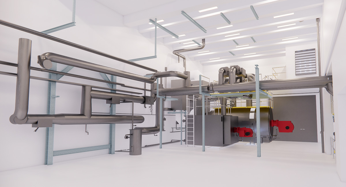
Modern buildings rely heavily on their Mechanical, Electrical, and Plumbing (MEP) systems for comfort, energy efficiency, and safety. But planning, in...
The excitement around virtual reality (VR) is enormous… it is EVERYWHERE! From commercial applications to domestic uses formerly reserved for gaming, ...

In the captivating realms of film and game development, the seamless fusion of reality and the digital is paramount. Bringing real-world locations and...
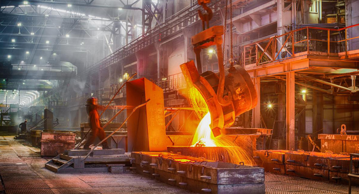
In the intense heat and demanding precision of the foundry and steel industry, success hinges on accurate measurement and intelligent digital planning...
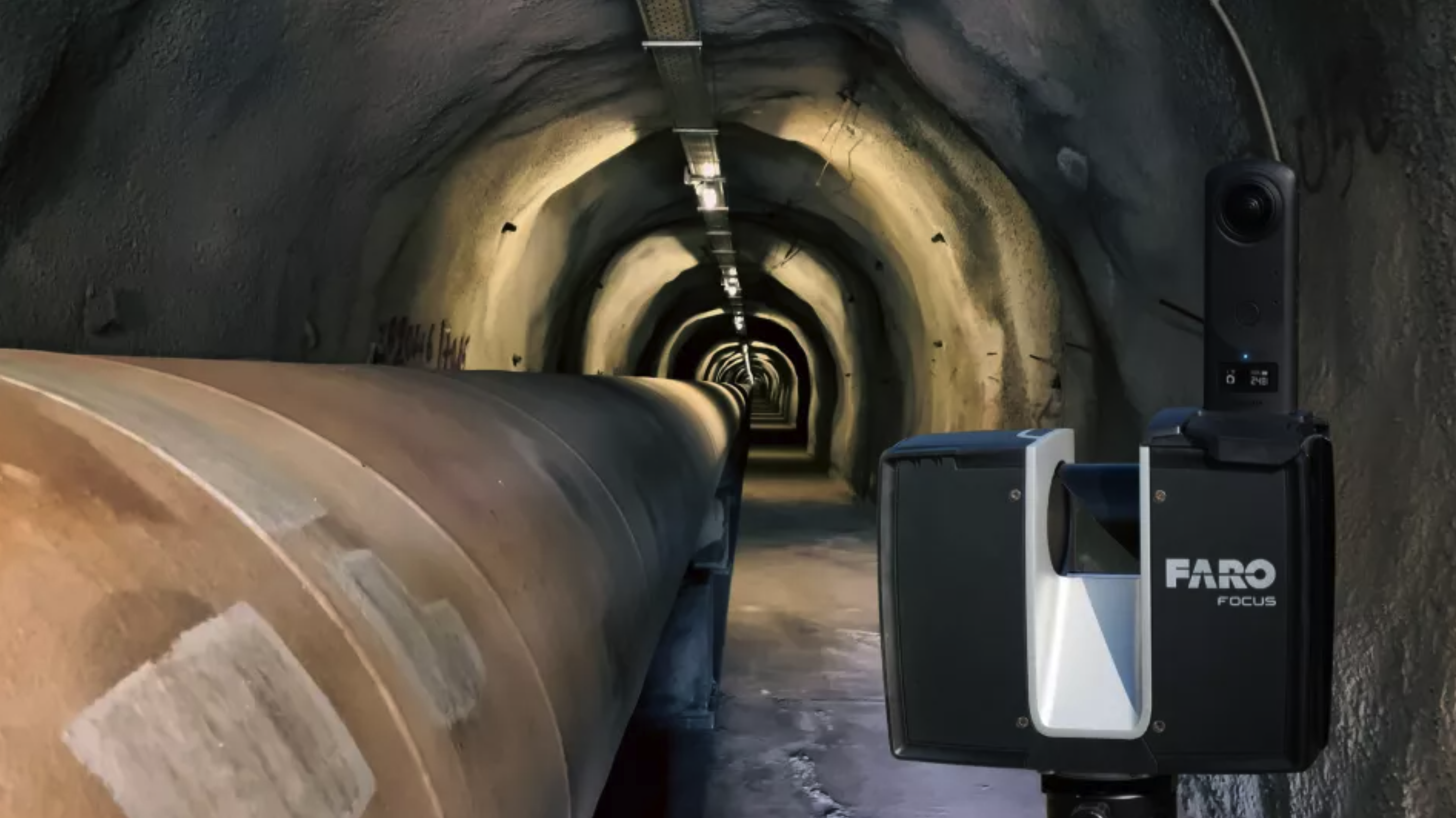
For those carving pathways beneath the earth and extracting its valuable resources, the ground truth is everything. In the demanding realms of mining ...
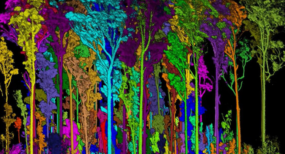
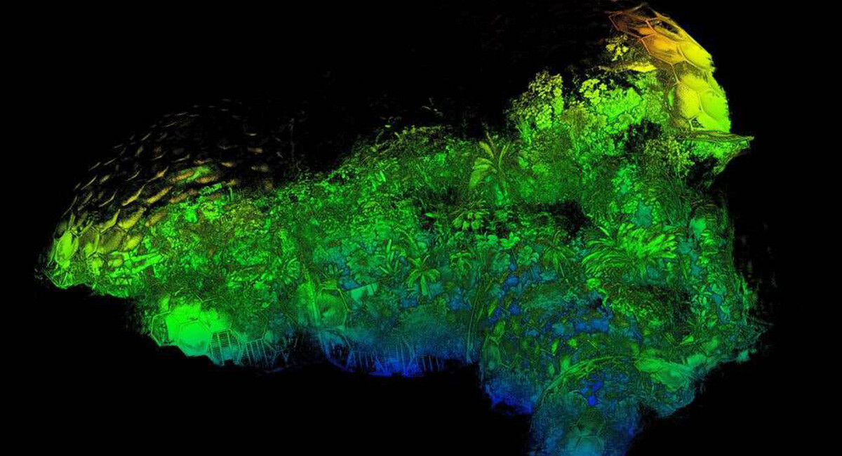
Mobile terrestrial laser scanning of NSW native forests
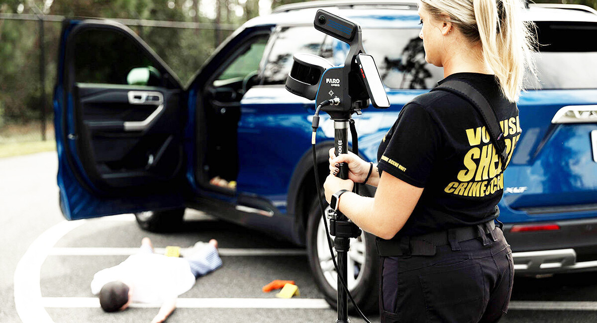
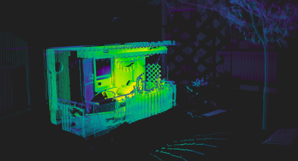
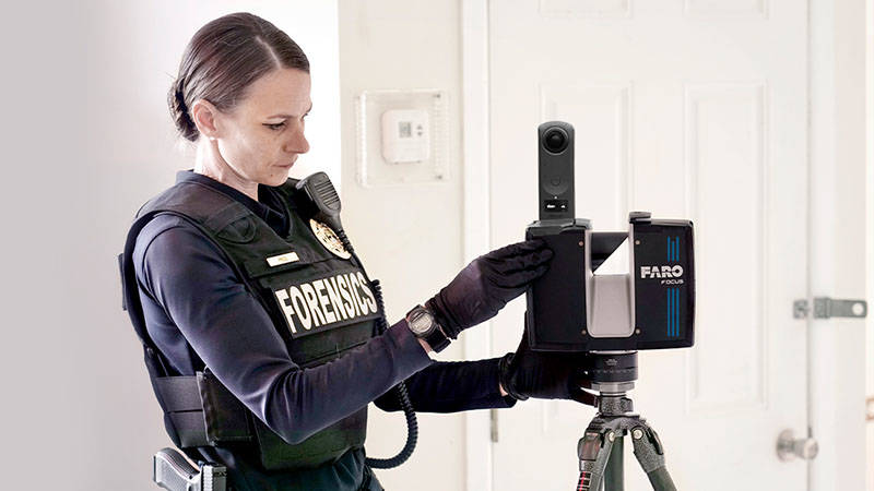
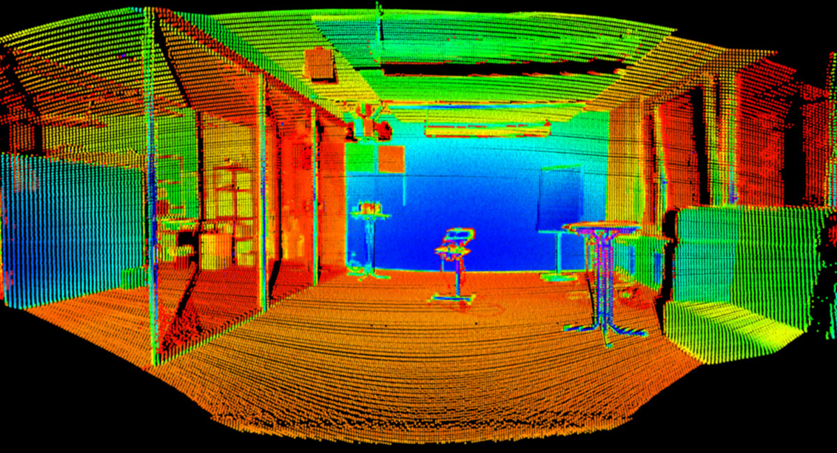
Forensic Laser Scanning: Advancing Crime Scene and Crash Investigation Laser scanning is rapidly gaining acceptance and becoming more commonplace in t...
Someone made a LiDAR scanner with a Raspberry Pi, and it looks awesome!
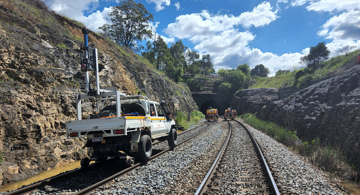
Agonics executes network wide mobile laser scanning (MLS) projects across iconic railway networks including ARTC, Metro Trains, V/Line, TasRail and Sy...
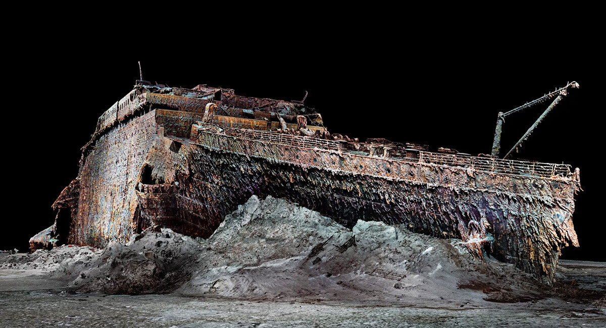
This rendering of the Titanic is based on 715,000 photos and millions of laser scans of the famous wreck, which were stitched together to create a per...
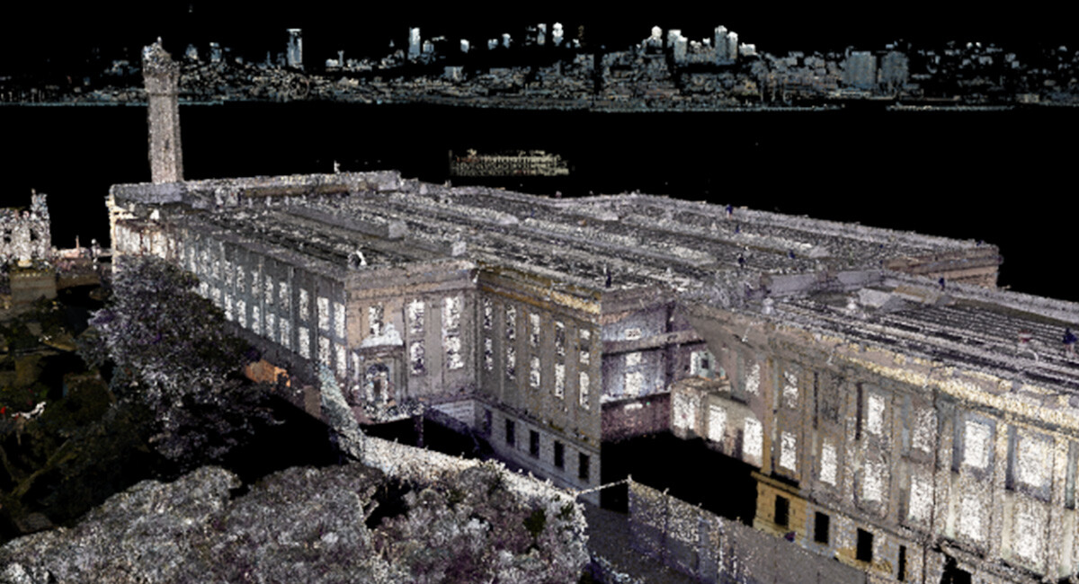
Exclusive Video Presentation: The captivating video, below takes viewers on a virtual journey through Alcatraz, revealing intricate details of the isl...
RIEGL technology played a crucial role in the successful release of high-resolution LiDAR data for the Palisades and Eaton Fire burn areas in Californ...
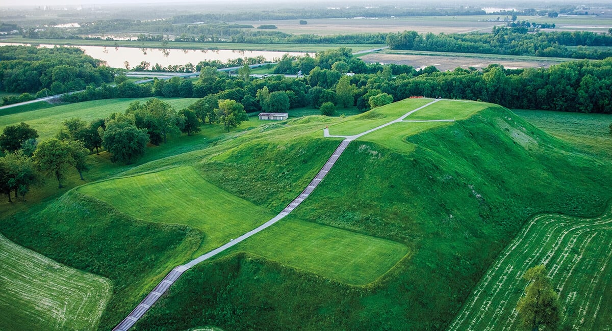
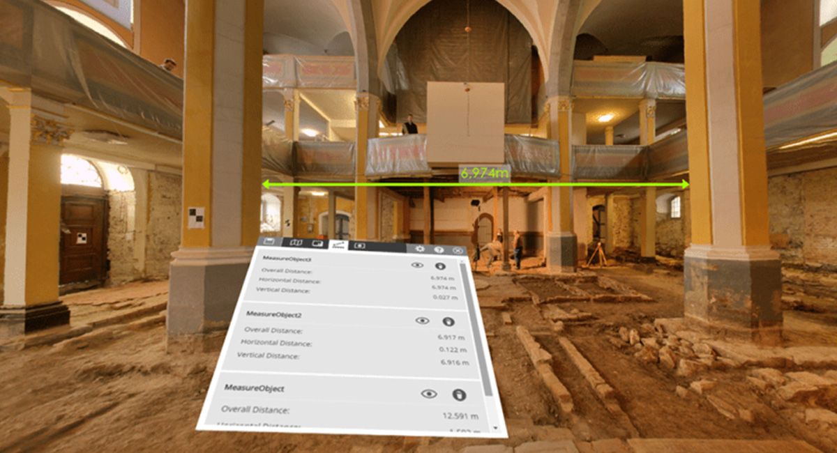
In a groundbreaking collaboration, RIEGL‘s advanced geospatial technology is playing a pivotal role in uncovering the mysteries of Cahokia Mounds, one...

Ron Chapple, Vice President of Global Strategic Solutions at NV5 Geospatial and former CEO of GEO1, speaks about how he and his team use RIEGL LiDAR t...
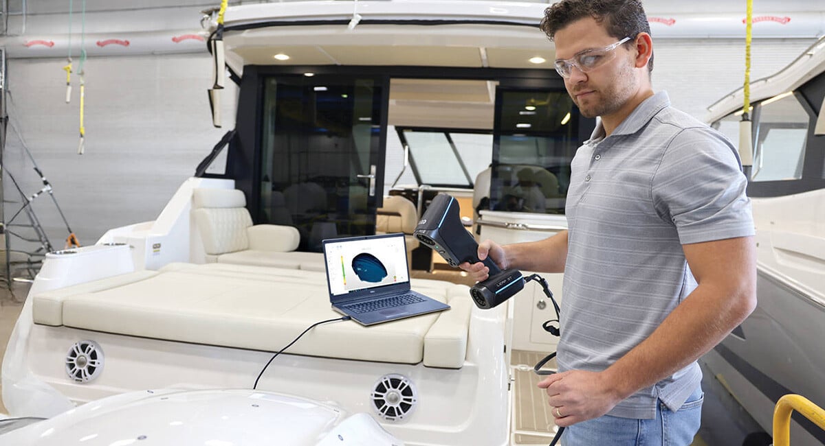
How FARO Leap ST is Revolutionizing Marine Applications with 3D Scanning Charting New Waters: How FARO Leap ST is Revolutionizing Marine Applications ...
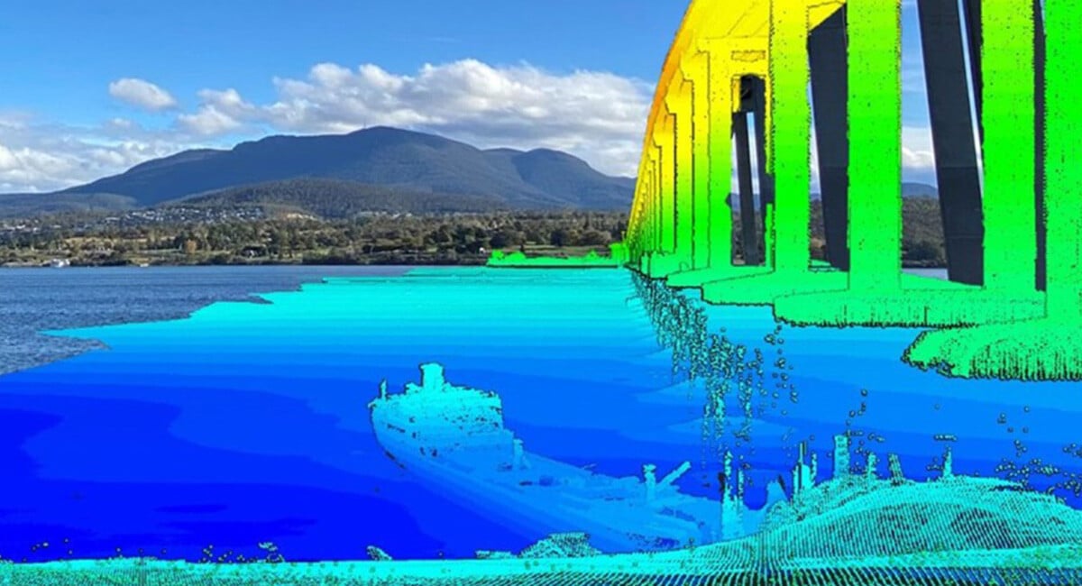
The first-ever ultra-high-resolution spatial digital twin of the SS Lake Illawarra and the Tasman Bridge reveals remarkable detail.
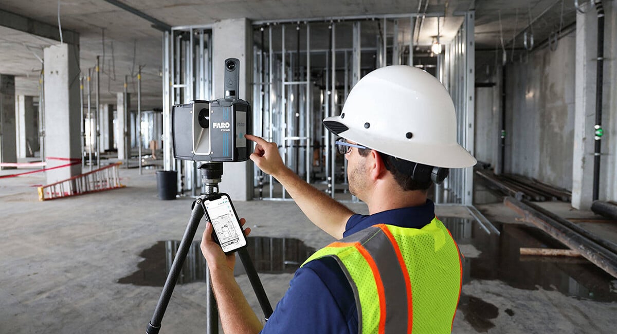
Picture this scenario: You’re a contractor. About to begin work on a complex project, a mall, for instance, or some other large structure. When comple...
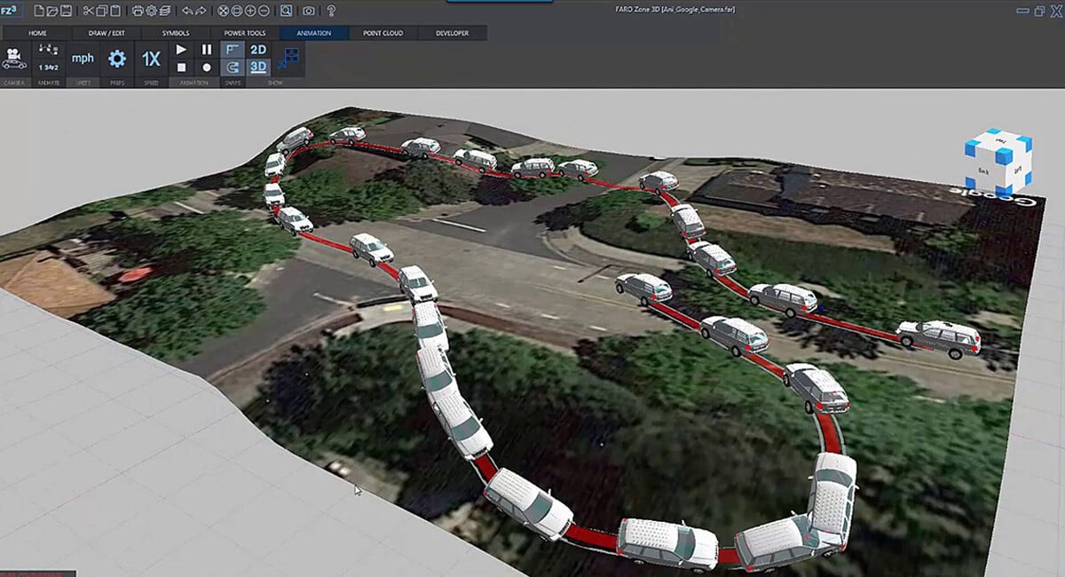
One portfolio, three solutions. That’s what you get when you enter the exciting world of FARO Zone Software, Public Safety’s go-to tool for diagrammin...
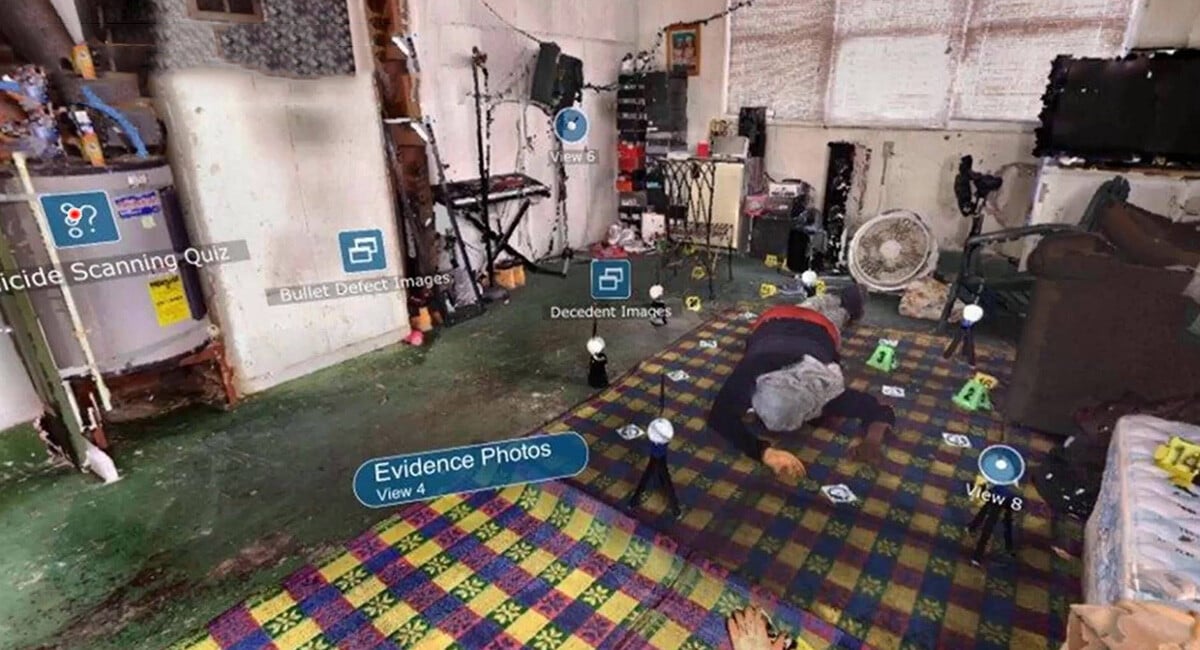
SUCCESS CASE: OEC Forensics Achieves Complete Preservation of Evidence with 3D Laser Scanning Forensic experts reduce overtime 25% & improve court...
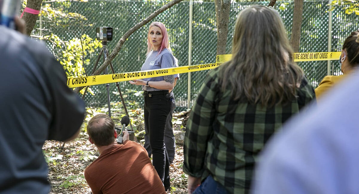
CSI training, from proper equipment usage and forensic documentation, to eliminating human bias, is a multifaceted process. Public-private partnership...
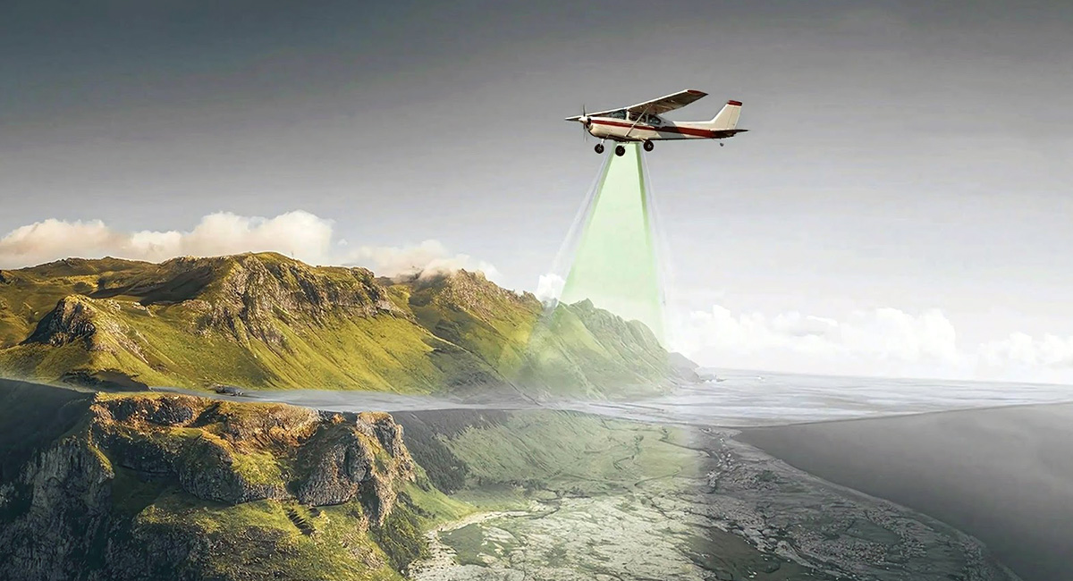
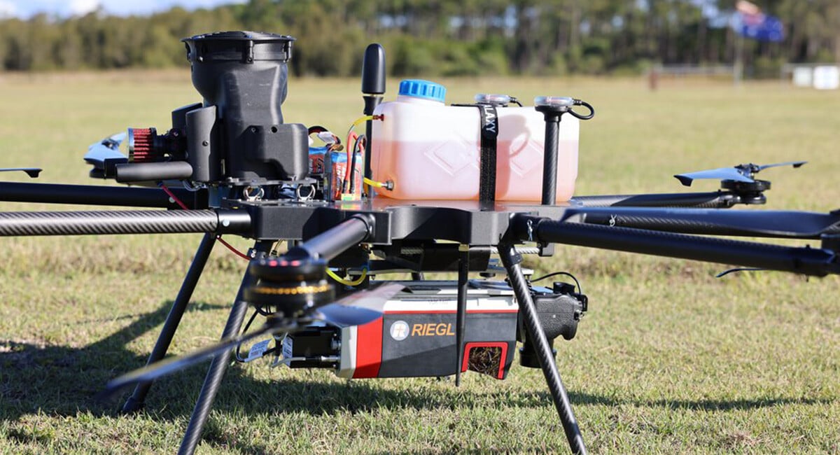
A Schiebel Camcopter S100 UAS fitted with a RIEGL VQ-840-G Bathymetric Lidar Sensor uses green wavelength laser beams to penetrate water and create li...
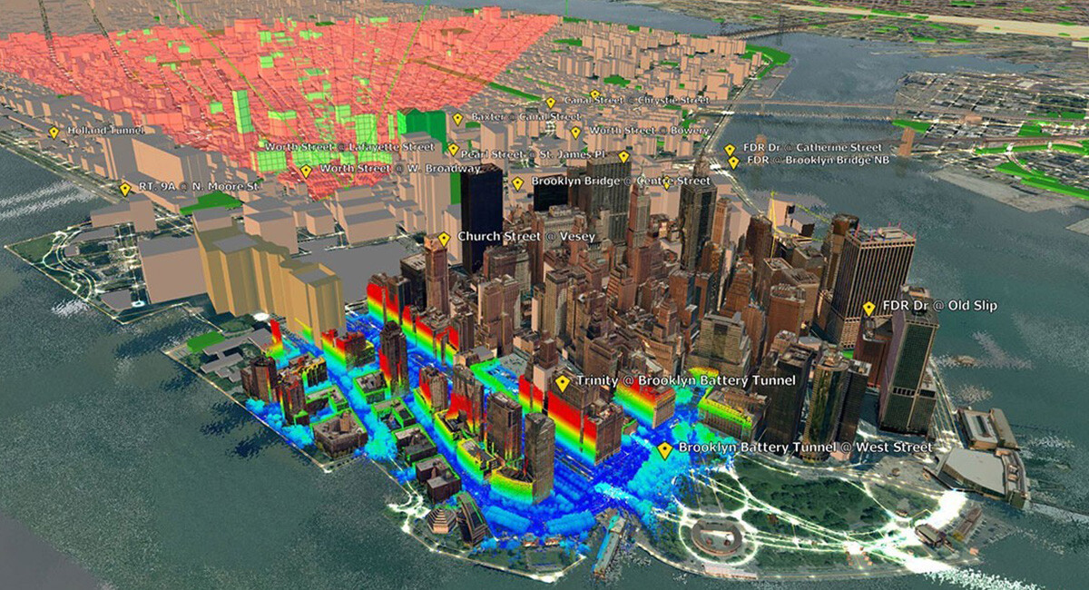
Pre-incident planning is a vital tool public safety professionals use to help save lives in a crisis. By knowing the physical layout of a building in ...
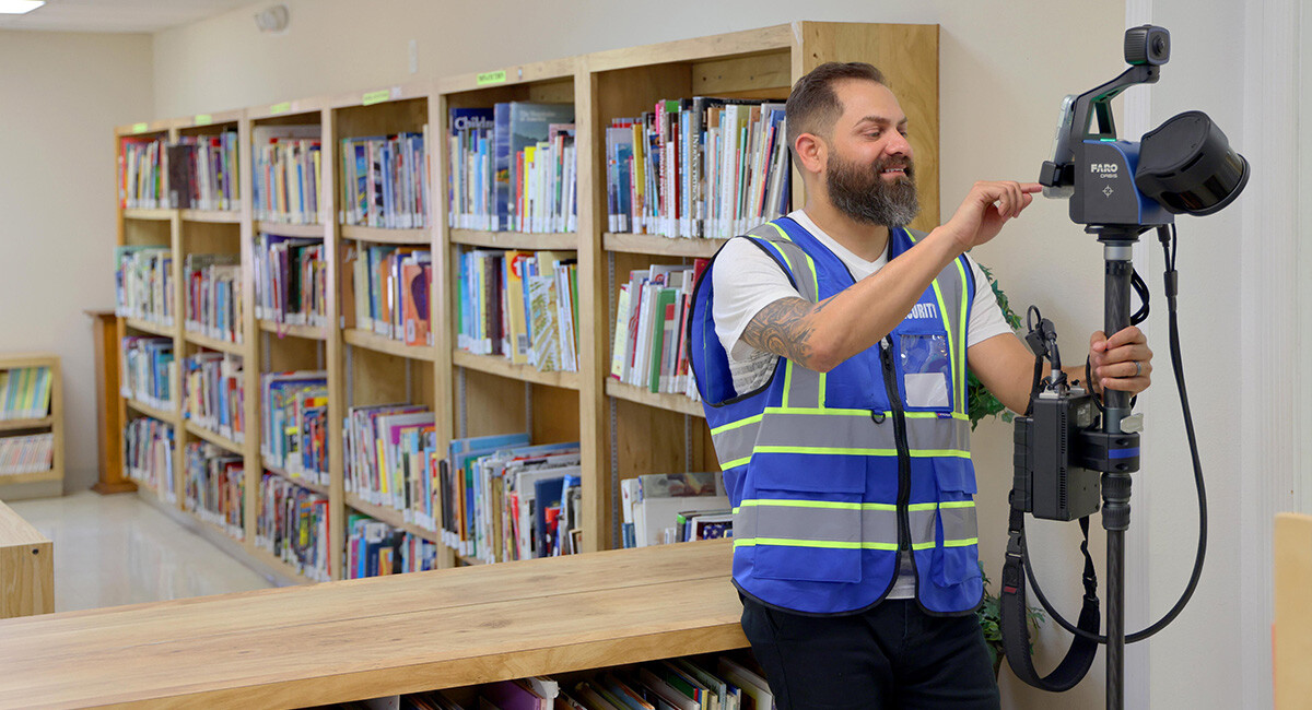
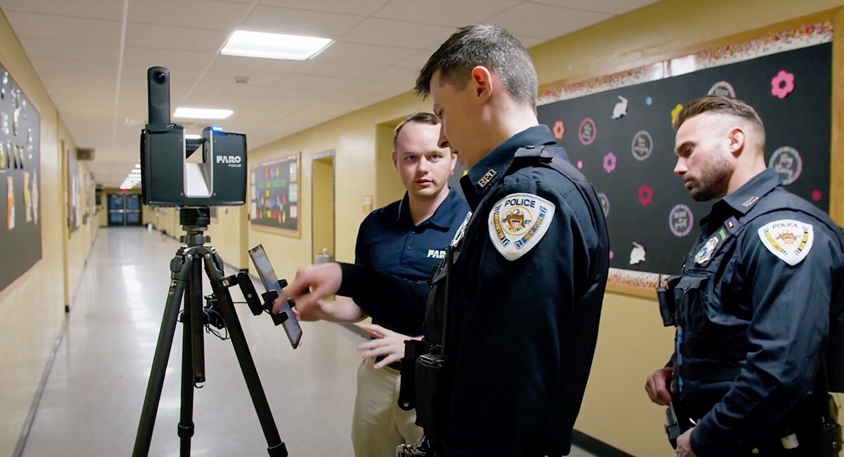
One way schools can improve student safety is by creating and keeping up-to-date digital floorplans for administrators and first responders to use qui...
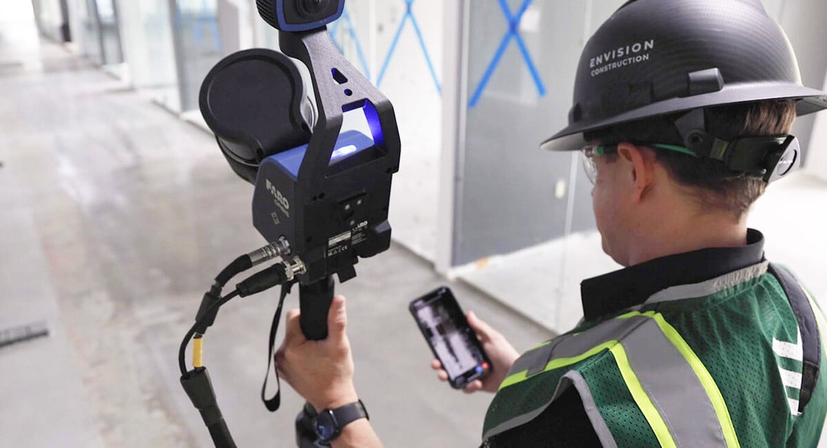
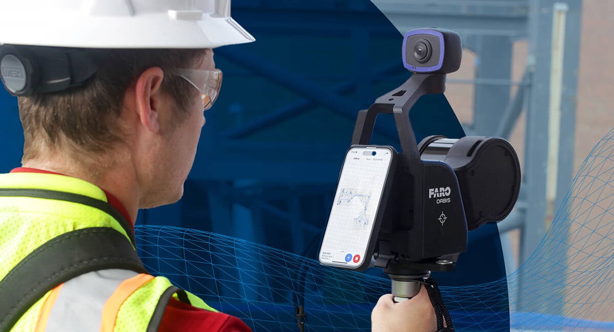
Watch the video below to find out how Envision uses Orbis to accelerate project timelines and minimise the labor-intensive registration processes asso...
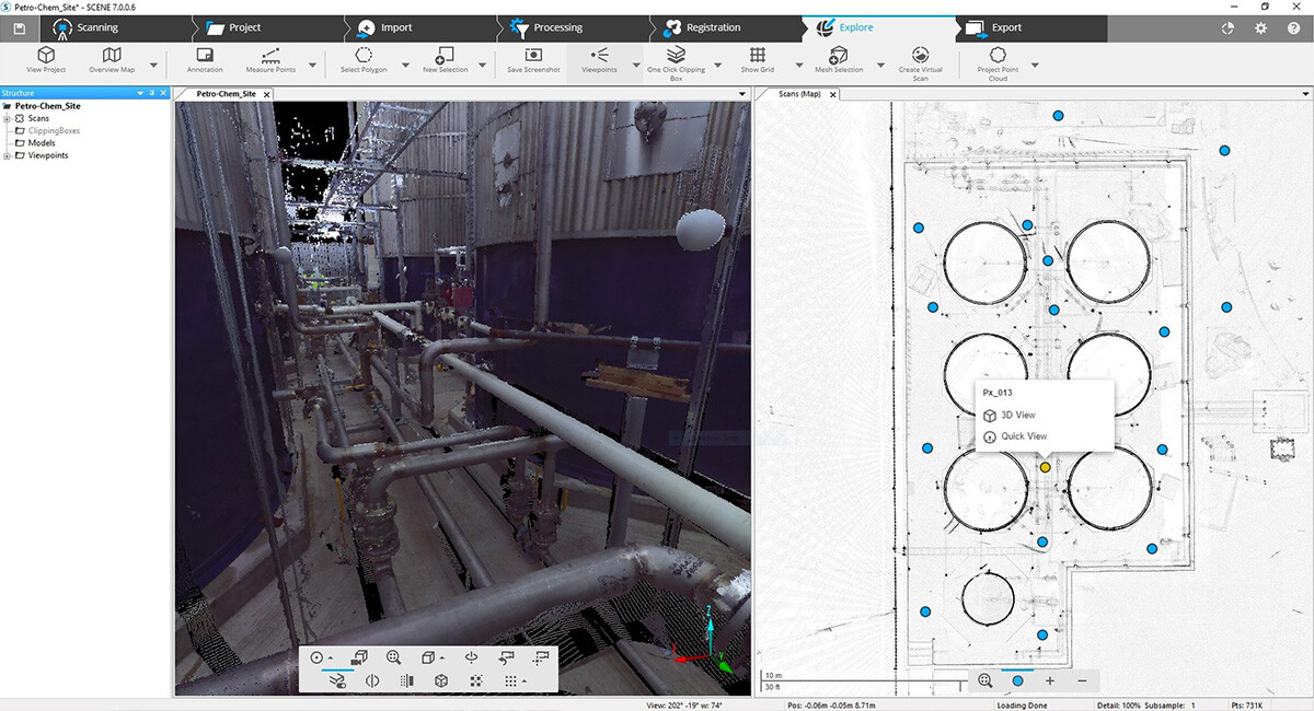
FARO SCENE Software is the industry’s leading registration software, engineered to make complex on-site projects simpler and more efficient. SCENE off...
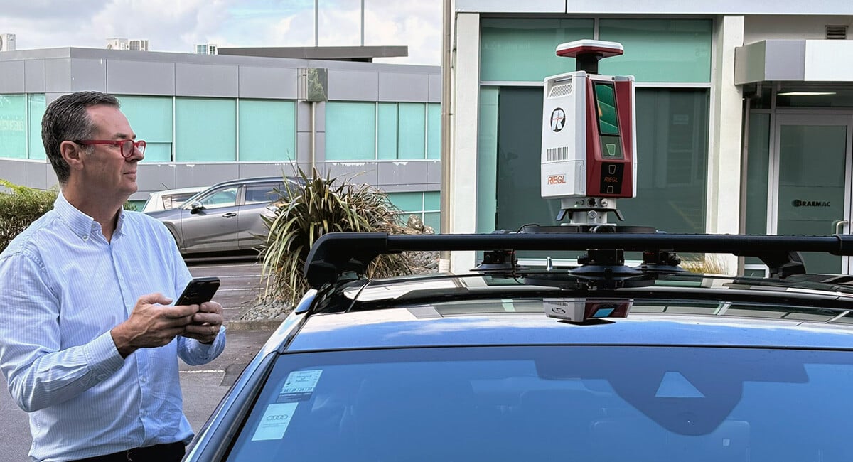
Citisurv is a professional surveying consultancy based out of Sydney and serving NSW. Citisurv has an extensive operational history going back to 1972...
From the roads that we travel on to the buildings we live and work in, civil engineering is all around us. The centuries-old profession has shaped the...
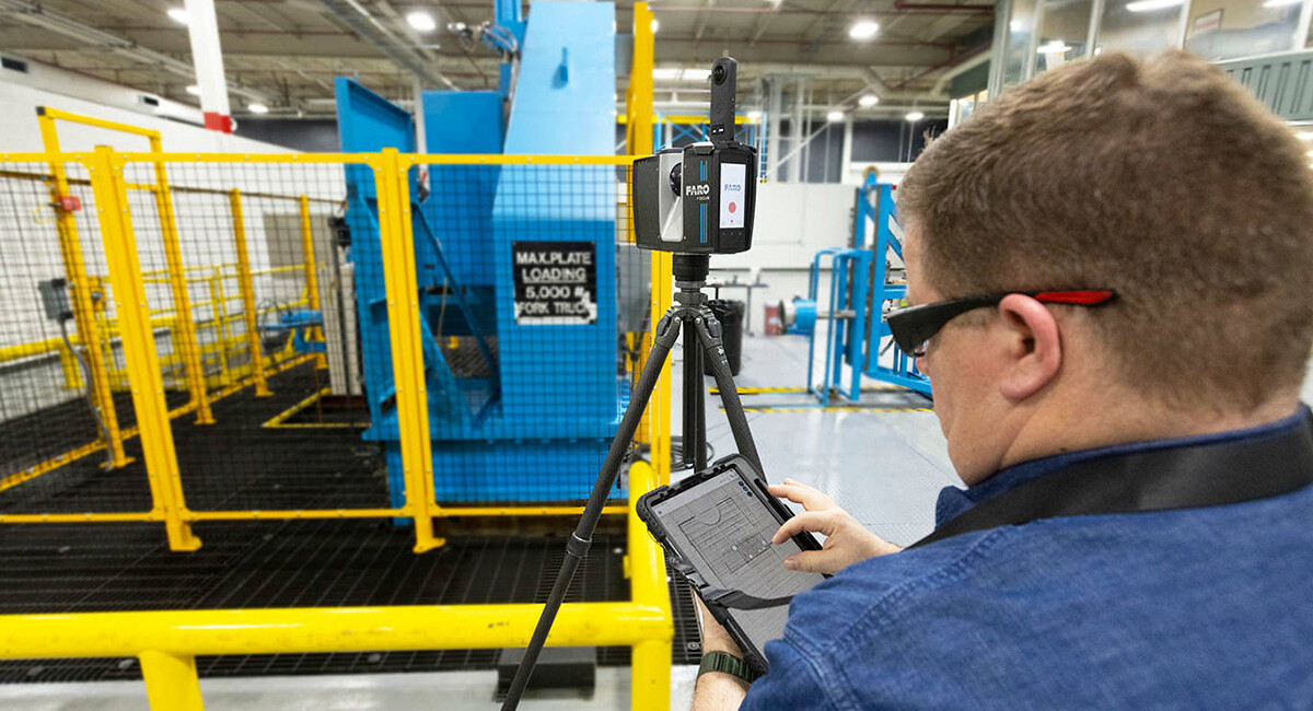
Mechanical, Electrical, and Plumbing (MEP) systems are the backbone of modern building construction. These systems ensure the functionality and comfor...
Although first conceptualised in the 1970s, creating building models was not commonplace due to the expense and limited commercial availability of the...
How the Admissibility Standard for Expert Testimony in Court Has Evolved In places like the United States, the term “expert,” especially in legal proc...
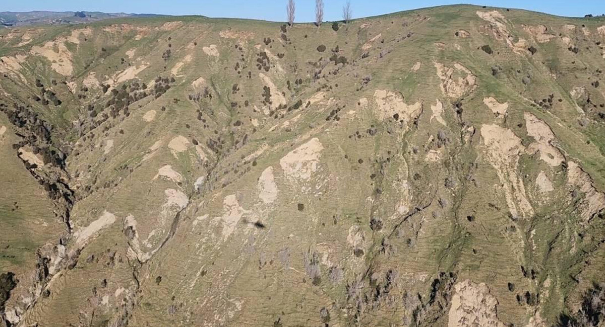
Scientists Map Impact of Cyclone Using Airborne LiDAR - 20 million tonnes of silt and sand was dumped on Hawke’s Bay’s floodplains during Cyclone Gabr...
Public safety agencies constantly face the challenge of making informed decisions in high-pressure environments. Whether responding to car accidents, ...
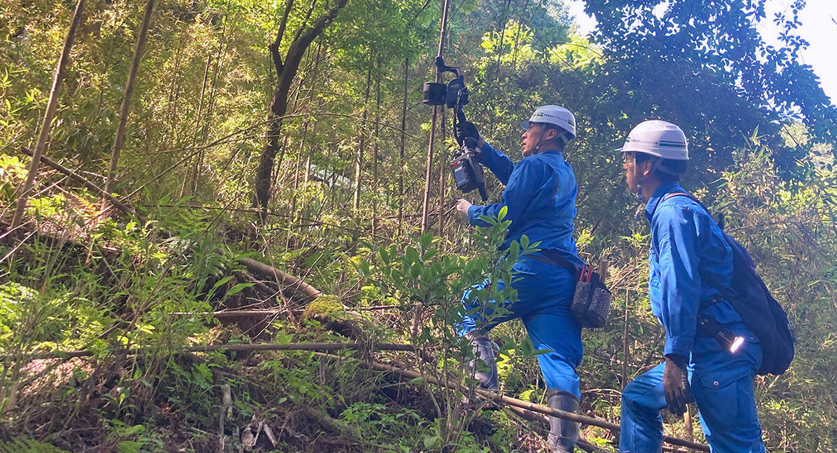
Introduction: Embracing Innovation in Surveying In a region where the surveying industry is still largely dominated by 2D methods, Hayashi Survey Tech...
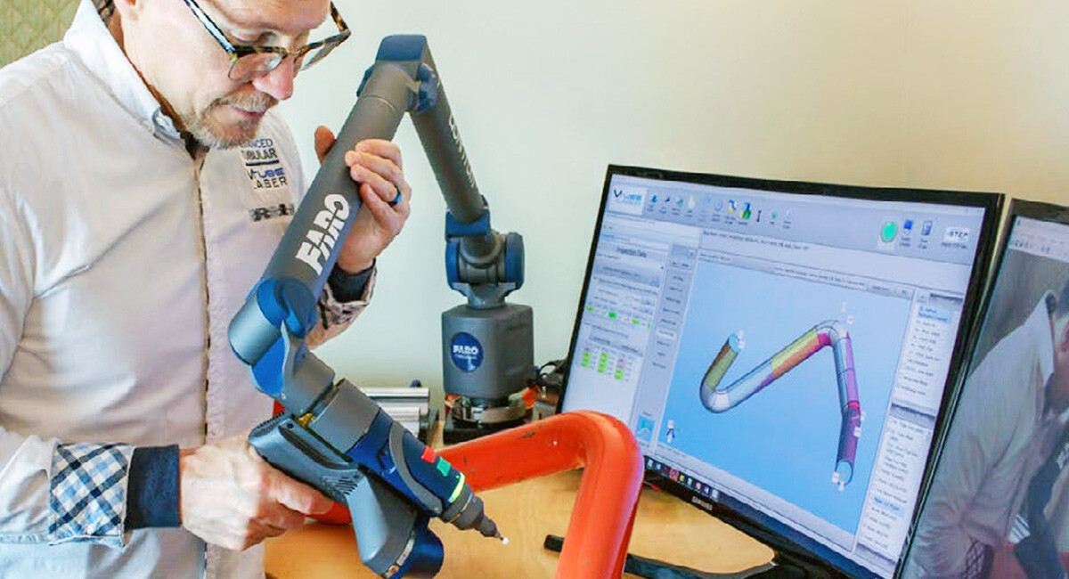
VTube-Laser and FARO Quantum Arm are the Winning Combination for Tube Measuring. In the manufacturing universe, metal tube fabrication is a world of i...

Arbormeta strive to improve the management of the living planet by providing the analytical tools necessary to properly know a forest and its trees. T...
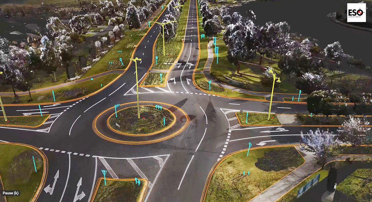
ESO Surveyors (ESO) provide laser scanning deliverables directly to designers or as an additional service to construction projects. ESO can supply poi...
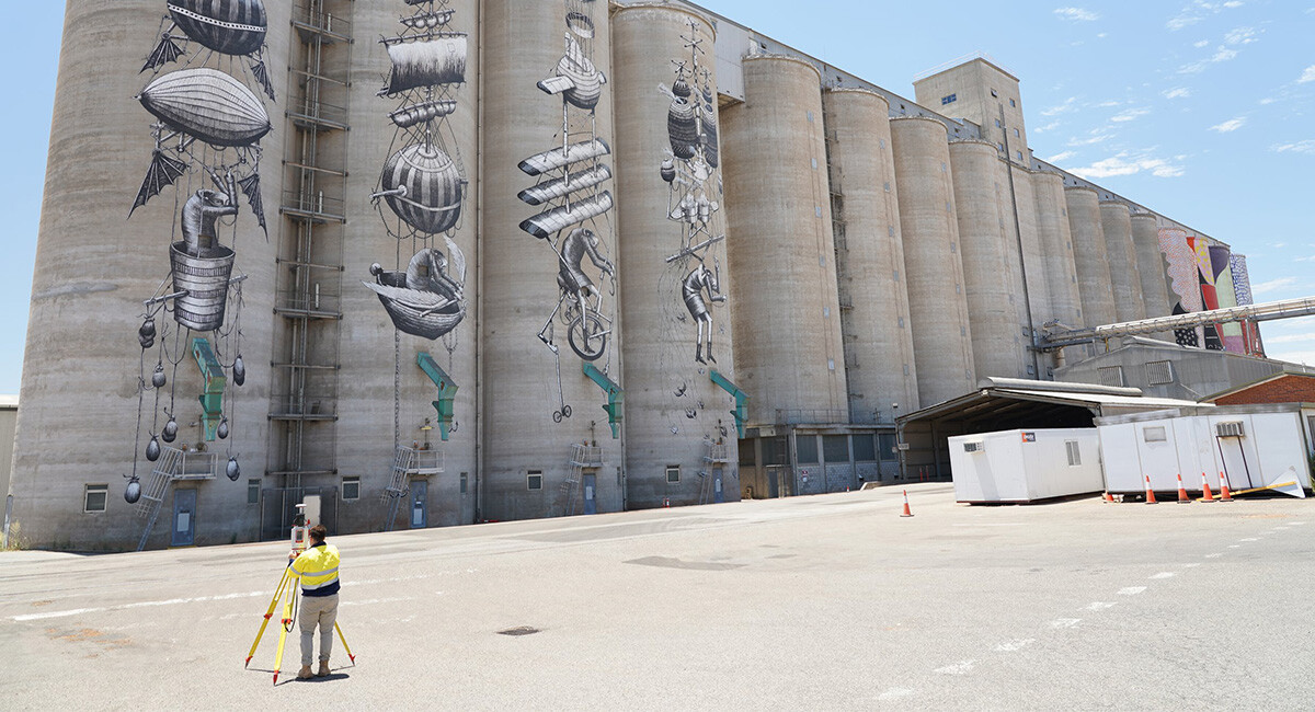
Digital Twin of CBH Grain Terminal in Western Australia captured and supplied by RM Surveys using the RIEGL VZ-400i terrestrial laser scanner. The pri...
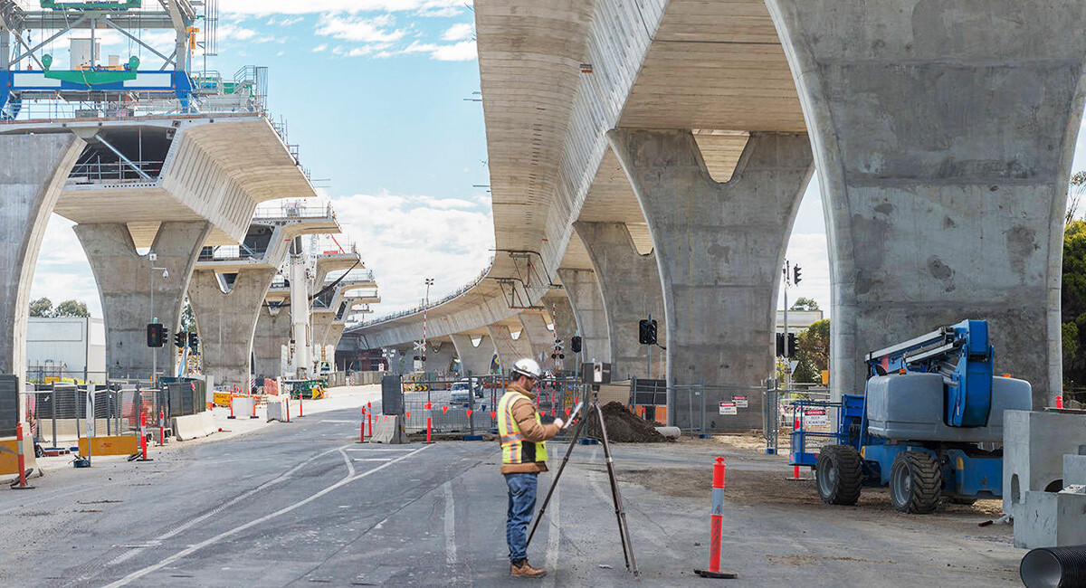
Bridge inspection – the process of assessing the condition, safety, and functionality of a crossing to ensure it remains structurally sound – is essen...
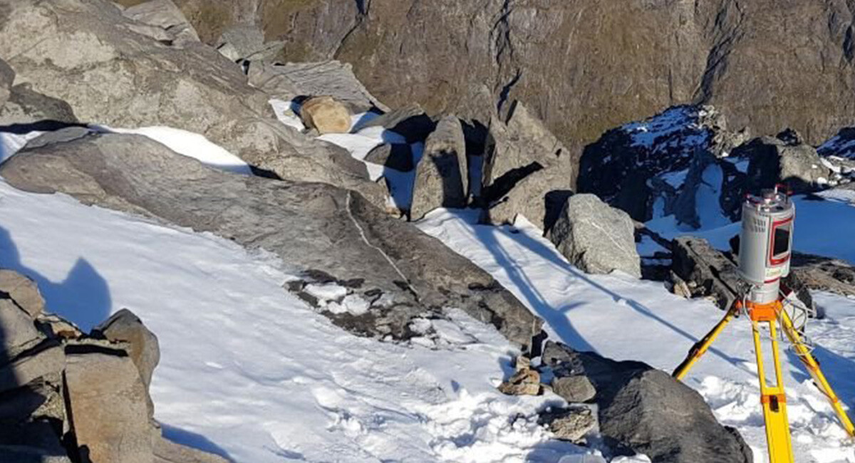
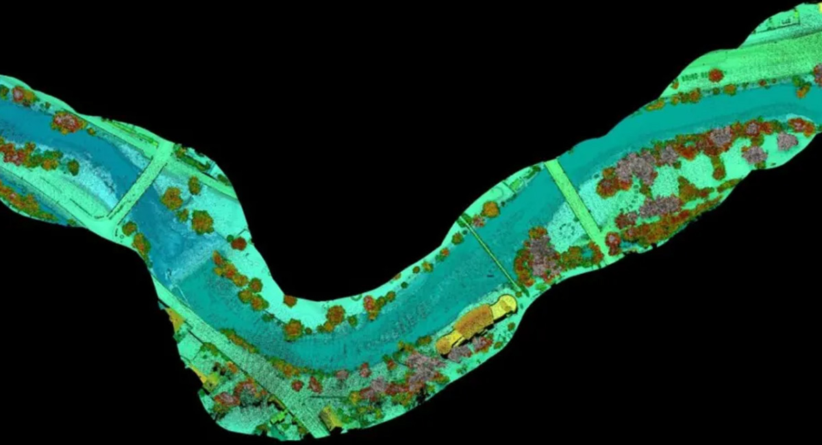
A project in Aotearoa/New Zealand is combining the use of high-quality DEMs from satellite photogrammetric mapping (SPM) with Lidar technologies to mo...
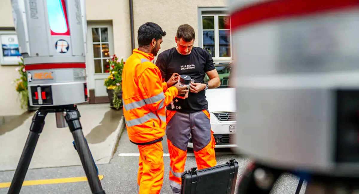
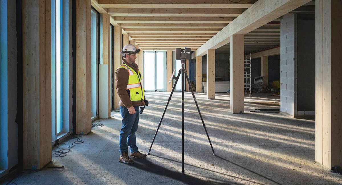
The Switzerland based Villa Digital Engineering AG has stood for technological excellence in laser scanning and digital modeling for over fourteen yea...
With a measurement range of up to 4,600 meters, RIEGL‘s latest generation of long-range professional laser scanners enhances productivity, ensures rel...

In those early days, the Chief Engineer was almost always the Chief Pilot as well. This had the automatic result of eliminating poor engineering very ...
Over the course of 71 years a lot of changes can happen. Some of them encouraging. Some of them less so. In 1953, for instance, Speedcode, the first h...
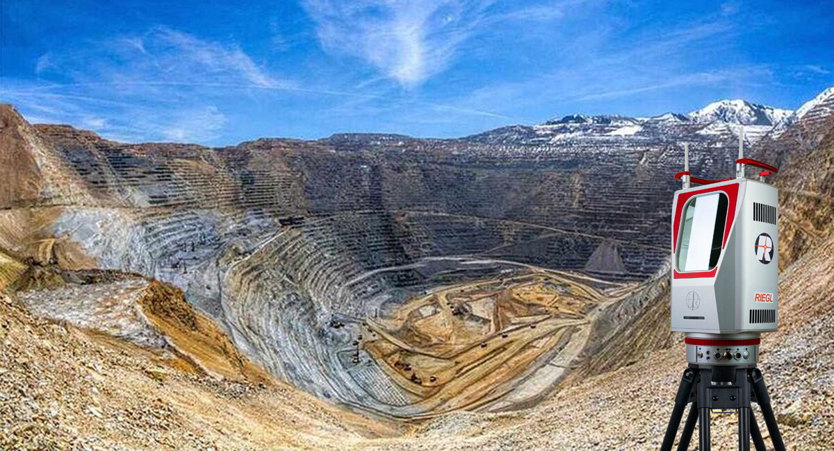
A recent article by Global Mining Review, in collaboration with Markus Handl from RIEGL Laser Measurement Systems, highlights the versatility and prec...
Research and development of digital technologies for the forestry sector are transforming the industry and the way humans impact forests around the gl...
Learn how Moriwaki Engineering Co., Ltd. increasingly relies on 3D laser measurement technology by FARO to scan and probe small parts in the developme...
With RIEGL’s VZ-i Series Kinematic App, your RIEGL VZ-i terrestrial laser scanner can easily convert from static to kinematic use – watch the new vide...
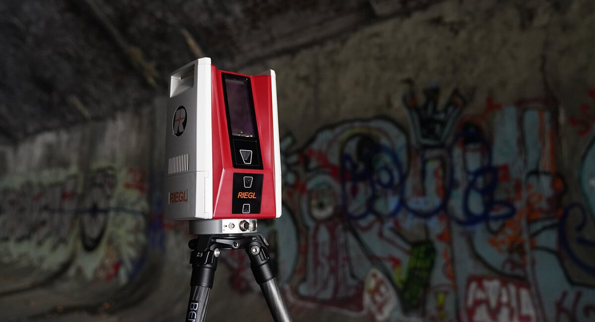
This webinar highlighted the RIEGL VZ-600i, a state-of-the-art terrestrial laser scanner that will streamline your projects with its unparalleled prec...

Land surveying is a field dedicated to measuring, documenting, and mapping the world. An ancient discipline in which surveyors aim to deliver informat...

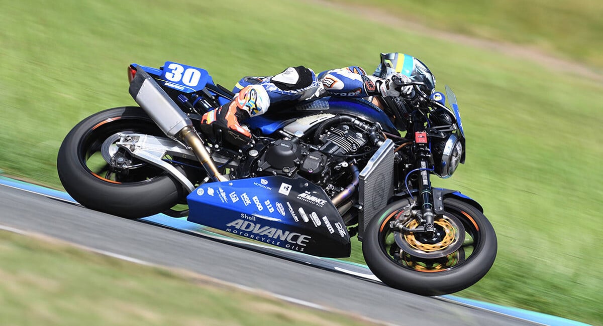
FARO has put its corporate foot forward and joined eight-time NASCAR champion RFK Racing as part of its tech incubator, the TeK Alliance. The division...
Introduced in the 1960s, LiDAR technology originally measured large areas of terrain by mounting scanners to airplanes. Like Radar (Radio Detection an...
When are we, I ask you? Sometimes we think we know where we are, but we really don't know when we are. - George Carlin, American Comedian, 1937-2008 O...
The calendar may have read January, but for millions of Europeans it felt more like May or even June as "winter" temperatures soared. When heat waves ...

Subscribe to our Newsletter
Stay updated on new articles and industry trends.