Fill out the form with your application and requirements and we will find the right product for your needs or continue scrolling for the Product Catalog.


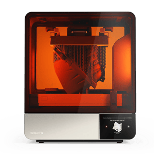
NEW FormLabs Form 4L - BIG Parts, Blazing Fast. Order Yours Today!
.jpg)

Topcon's Millimeter GPS System is the World's First GPS based millimeter accurate control for milling machines. Topcon's revolutionary Lazer Zone™ technology based, Millimeter GPS uses GPS positioning together with a zone laser reference to give you unparalleled freedom and productivity. Topcon’s Millimeter GPS Milling has the simplicity of a laser, accuracy of a robotic total station, and multiple user capabilities of GPS.
Positioning Zone Laser Transmitter operates similar to a standard rotating laser, but transmits a unique Lazer ZoneTM signal to provide a working range of 2000ft! Instead of a traditional flat plane, the PZL-1 provides an incredible measuring area of 33ft in height! You can even link up to four laser transmitters for use on large sites to cover a distance of nearly 8000ft with elevation changes of over 130ft! No more taking time out to reposition your laser. With the PZL-1, multiple machines can use the same transmitter, even at different elevations for continuous production!
The PZS-MC (Positioning Zone Sensor – Machine Control) mounts to your paver in the same manner as traditional laser receivers. Unlike traditional laser receivers, the PZS-MC knows it’s exact position within the 33’ vertical working range of the PZL-1 at every moment. With its integrated GPS antenna, the PZS-MC antennas continuously and accurately provide elevation and horizontal position information to the Control Box containing the digital site plans.
Using the mmGPS LaserZone™ transmitters for Vertical referencing the 3D milling system holds a high degree of accuracy in all applications. Strategic placement of the mmGPS transmitters allows the entire project to be covered by mmGPS.
Eliminate any vertical fluctuation of GPS by using mmGPS LaserZone™ technology. The transmitters lock in the elevation on both the machines and the survey rovers to eliminate fluctuation and provide vertical data that will match not only from machine to machine, but from machine to rover.
By using up to four mmGPS transmitters the entire project can be covered. This features allows for continuous operation on both the machines and the survey rovers. Cover up to 2000' of highway or surround a job site with mmGPS transmitters to eliminate downtime and ensure accurate elevation control throughout.
Joint matching? Vertical Curve? Horizontal Curve? No problem with mmGPS! Using a 3D design file to control the machine all the transitions are accounted for and will be precisely constructed. They can be verified with mmGPS on the survey rover for quality control.
The mmGPS system uses all the same main components as other 3D Machine Control Systems. Simply add in the precise vertical control with mmGPS and you have a true plug and play system! The same main components can be swapped from machine to machine to us on all machine types. 3D Dozer system one day, 3D mmGPS milling machine the next!
See how Wiregrass Construction was able to meet tight specs for runway repaving job at Huntsville International Airport in Huntsville, Alabama using Topcon’s Millimeter GPS Profiling systems.