FARO | Best Practices for 3D Survey Scan
When combining data from different surveys, it is important that the site in question has a control network with established coordinates common to all collected data. These coordinate systems can be local or global and are imperative for accurately combining different data sets into one usable project.
Once survey control is established by adding spheres or checkerboard targets to the site, the scan data (point cloud and HDR 360o Photos) can be georeferenced to other data.
Survey Control, 3D Scans, and Georeferenced Data
Often, survey control and georeferenced data are, for architects and engineers, two sides of the same coin. It is the process by which reference points are taken and positioned around a site, serving as anchors for aligning scans, drawings, or maps. When data from tools like 3D laser scanners is collected, software uses these control points to position and scale the data within a real-world coordinate system. That is the georeferencing part —tying digital information to real geographic locations.
What You Can Expect to Gain
Reduce errors: Survey control with laser scanning reduces time and cost-multiplying errors. Early identification of issues cuts down on costly delays downstream that could result in lower productivity, miscommunication, and avoidable fines or incorrect materials orders. Georeferenced data brings the ability to compare the point cloud against 3D models, 2D drawings, and other survey data (on the same control network) in over 50 different formats. The user can check progress, highlight potential problems, put tasks in place to resolve those problems, and share the data, enabling joint informed decisions to be made without the need to visit the site.Improve efficiency: Laser scanning is labor-efficient. By some estimates, you can trim onsite data-capture time by as much as 70% over traditional surveying. Since georeferenced data is accurate, you limit the risk of having to return to the site due to missed measurements. The data can be uploaded directly from the FARO® Stream app to FARO Sphere XG or processed back in the office in FARO SCENE.
Importing Datasets Into One Software Solution
Utilising software like Sphere XG, users can have the added capability of bringing all these datasets into one secure online portal. By uploading the scan data, 360ﹾ Photos, BIM, and 2D drawings into Sphere, users benefit from the real-time ability to compare and analyse the collected data, highlighting any clashes against design and thus pre-empting any potential problems.
Sphere can also share the data (small sections or the complete project, both internally and externally to the client) in a secure cloud-based format. This ability allows the project manager to assign tasks to individuals, add annotations and documents with key information, and add a completion date to ensure the task is completed—all without the need to travel or visit the site.
Equipped with these tools, architectural, civil engineering, and construction professionals will be better able to manage and share data, ensure projects are running to schedule, and share data with those they wish to without visits to the site. Most importantly, complete projects more efficiently whilst still ensuring the highest level of accuracy and precision.
Best Practices for Achieving Precise Georeferenced Data
When considering adding 3D laser imaging, it’s important to keep in mind best practices for its use to make sure you get the most from your investment. By understanding this, you can train staff and work to make implementation easier and faster from the beginning.
Survey Control Step-by-Step
Step One: Ensure collaboration between the field and operations. When field and office staff understand each other’s requirements and workflows, they communicate more clearly, collaborate more effectively, and better review the field and operations workflows so each group understands what’s required to produce and use the scans before implementing them. This is another place where Sphere XG is a great asset.
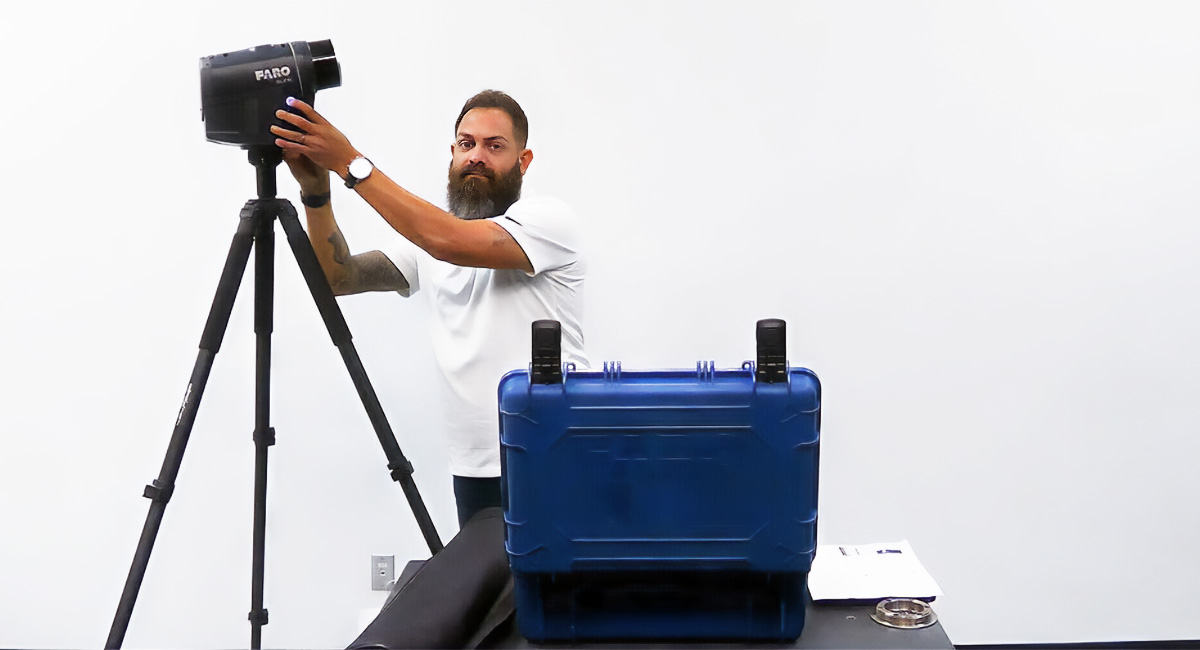
Step Two: Place targets strategically in the field. Targets must be positioned correctly to produce accurate scan registration. System algorithms recommend at least three reference points on each project to enable accurate georeferencing. Choose locations that aren’t likely to move — not a temporary railing or a stake, for instance — because that will negatively impact the coordinate system. Place targets spaced apart widely and at different elevations around the site to give the scanner plenty of reference points. Don’t place targets in a straight line or in a repeating pattern, which makes it harder for the scanner to define spatial relationships. Understanding how to position targets will help you quickly get the results you need from the first scan onward.
Step Three: Perform rigorous QA/QC. Putting too much trust in the software can be tempting, but it’s your responsibility to verify that things are measured, registered, and delivered properly. It’s especially important to use survey control for large, data-intensive projects. Sometimes there’s a hitch in the automated target identification or registration process. For each scan, validate targets by matching those in the scan with those you know are in the field and remove things incorrectly identified as targets. Investing extra time for a close look before pushing anything out to the client or project partner keeps errors from cascading through the project.
Important Factors to Consider When Selecting 3D Solutions
Five considerations when choosing a 3D laser scanner, for survey control.
- Does it meet all your firm’s needs? These solutions are important investments, so choose hardware and software with everything your teams need. Make a list of the features and functions your staff must have right now, plus those you anticipate needing in the future. Vet possible solutions against your list to ensure that the ultimate choice meets your firm’s specific needs for scanning, processing, and delivering high-quality data. If you’re already working — or plan to work — remotely or virtually, don’t forget to assess each solution’s mobile and cloud functionality.
- Verify interoperability and integration with existing systems. It’s vital that your new solution integrates with your existing technology stack. Inventory your current software and hardware and check it off against each solution’s requirements and functionality. You also want to make sure the software supports major laser scanner manufacturers’ data formats and is easily integrated into BIM. Bonus points if you consider compatibility with partners’ technology solutions, to ensure easy collaboration and data transfer. If you know your firm will grow, double-check each option’s scalability.
- Investigate provider reputation. Because AEC projects typically have a long lifecycle, you’re better off choosing a technology partner that’s going to be there for you. Give special consideration to providers with proven track records and trusted software and technology. Review case studies and talk to colleagues about the providers they work with to vet each potential partner.
- Choose a provider that offers training and support after the sale. Users need training to effectively and efficiently use the laser scanning hardware and software. Go with a provider that sells a complete package of training and support. On- or off-site instruction upfront is critical, as is ongoing support for upgrades and new feature sets. You also want a sales engineer to help you develop workflows, streamline processes and troubleshoot. Ongoing technical support is critical.
- Test-drive the system. Because your team will use the solution every day, it’s essential that staff test-drive the software and hardware to evaluate ease of use and other factors.
Advantages of Choosing FARO's 3D Solutions
A portfolio solution that includes all the hardware and software necessary for survey control with laser scanning is the best way to meet your firm’s needs and deliver maximum return on investment.
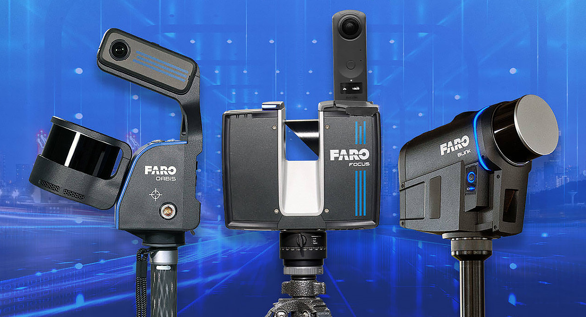
FARO provides 3D hardware and software solutions for data capture and 3D visualisation that are designed for architecture, engineering and construction, plus geospatial sectors. The technology enables professionals to transfer real-world information into the digital realm. The seamless solution and workflow make capturing data efficient and accurate, so you can process it into deliverable CAD plans and BIM models. Scanners capable of adjusting to control points to georeference the processed 3D data include the FARO Focus Laser Scanner and the FARO Orbis Premium Mobile Scanner.
Use this information to champion survey control with 3D laser scanning at your firm and to purchase the best technology you can afford. Gather, manage and analyse actual conditions for better planning, verification for site and industrial facilities maintenance.
Want to learn more about 3D laser scanning and how FARO software can help address your 3D scan survey control needs?