Topcon mmGPS - Unprecedented Accuracy
"There’s simply no way we could have managed this scope of work any other way." Mike Graham - Higgins.
CityEdge Alliance is a group of companies collaborating on the 22 km 4-lane Hamilton section of the Waikato Expressway, due for completion in 2020.
Hamilton’s biggest-ever roading project, the Hamilton section will connect the Ngāruawāhia section of the expressway to the Tamahere and Cambridge sections. It will reduce traffic congestion, improve safety, reduce fuel costs and boost economic growth regionally and nationally.
The complex project involves the construction of 17 bridges crossing nine local roads, three deep gullies and a busy railway line carrying 30 to 40 trains a day to and from Tauranga.
A project of this scale brings together Alliance partners Fletcher Construction, Higgins, Beca, Coffey, Hicks Bros and the NZ Transport Agency with excavation, drainage, earthworks, environmental, construction and roading crews on site.
"With so many crews on site and parts of the project happening at once, accuracy and efficiency are incredibly important," says Mike Graham, from Alliance partner Higgins.
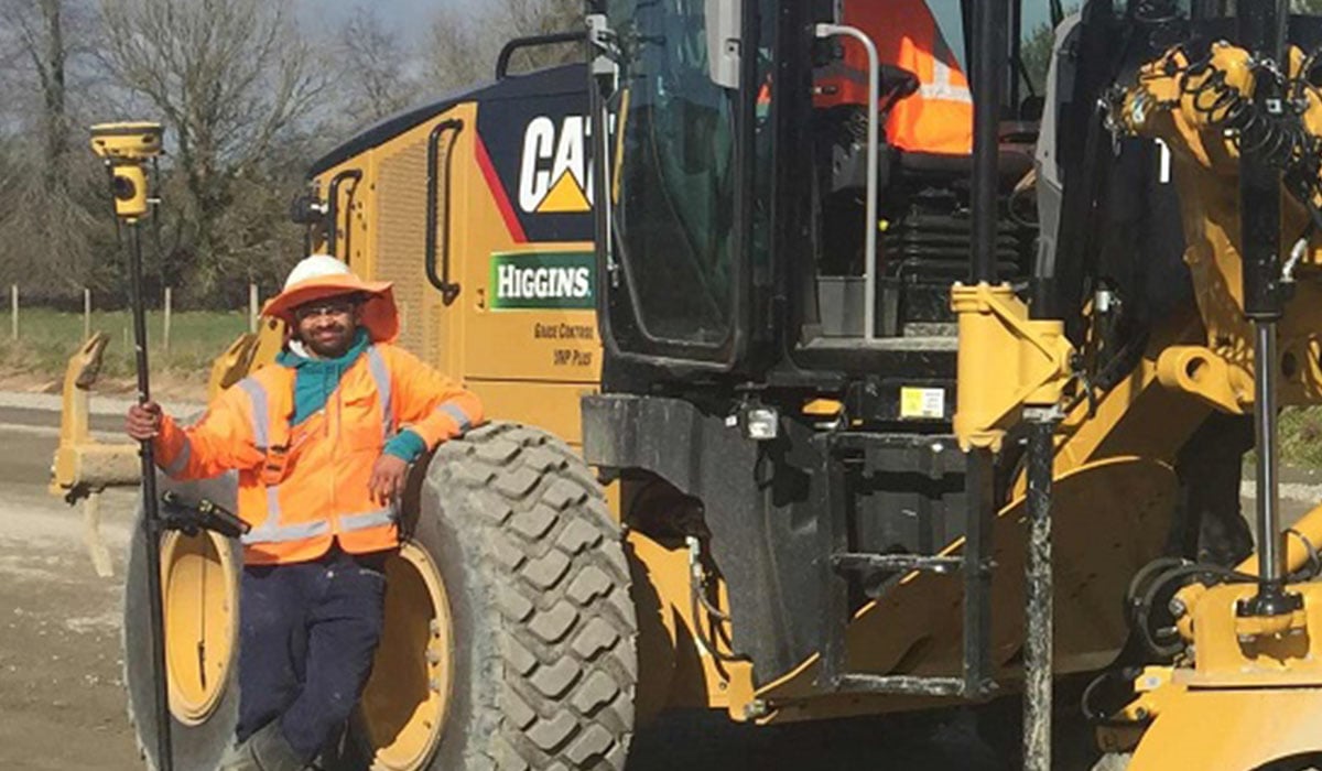
The pavement team on the project is using the Topcon Millimeter GPS+ system on four of its Cat 12M graders (along with other Topcon GPS equipment on its diggers). It’s the first time they’ve used the mmGPS and Graham notes,
"There’s simply no way we could have managed this scope of work any other way." The project stats are impressive: 21.8km of expressway, 4 million cubic metres of earthworks, 17 bridges, 28450 cubic metres of concrete, 1.3 million tonnes of aggregate. "With the volume of material going in there, time is money, so we looked at Topcon from the outset of the project."
Topcon’s mmGPS is ideal for large-scale sites where there are multiple machines operating in the same area, and where there are long runs – exactly what’s happening on the expressway project.
The first clear benefit is the accuracy enabled by the laser enhanced GNSS of the mmGPS, and the ability to work within tighter tolerances. For paving, it provides the speed and flexibility of GPS, with more than three times the accuracy.
The system uses special lasers transmitting over 400m and 20m high, so the Alliance paving team is using four of them over 600m, with four graders and four mm survey rovers hooked on to the same system. Tolerances are now only 1 to 5mms – something that would take four times as long to achieve with string lines.
As Graham explains, "It gives us much more accurate readings – over 22 kms of a 4-lane highway, if you’re 10 mm out, it starts to cost you money. So the client’s happy they’re not spending that money."
The second clear benefit is gained around time and labour involved. The system allows the use of multiple graders on the same site, running off the same gear. You can have unlimited machines graders and rovers working at different heights at the same time – creating significant efficiencies and time savings.
"Can you imagine if we were using string lines and needed a surveyor every 20 metres or so for 22 kms – on both sides? With an intolerance of 5mms?! That quickly adds up. This way we’re better, faster, cheaper and more accurate."
Asked whether the transition from pegs and string lines to lasers and 3D imaging has been a difficult one for some of the older operators, Graham is positive.
"I’ve been doing this kind of work for 25 years and can’t believe we haven’t used anything like this before." "There will always be people who are harder to accept change, but that’s young or old. The training and support from Synergy Positioning Systems has been great and once the crew use it, they realise how much better it is."
"Now if we have any questions, we talk to the Synergy team at Synergy over the phone and discuss any issues. That support is great because we couldn’t deal with having to wait for someone to arrive on site whenever we needed help."


